Abstract
The sustainable management of urban green spaces requires the monitoring of the structural parameters of theirs trees. This study, which was carried out in the cities of Abomey-Calavi, Allada and Cotonou in southern Benin, aimed to describe the dendrometric parameters and the rate of carbon stored by urban trees. The inventory of trees planted in two types of urban forests (greened public spaces and shade rows) was performed using the roving survey method at the level of each city. Then, presence and absence data of all trees, as well as diameter at breast height (DBH) >= 10 cm and height >= 2 m were measured. These data were analyzed using R 4.0.5 software. The calculated dendrometric parameters were subjected to variance tests to assess their significance. The different counts allowed us to identify 5128 individual trees. The density per hectare varied from 36.7 to 83.1 between cities and from 40.5 to 80.4 between types of green spaces. Basal area varied from 2.25 to 11.4 m²/ha within cities. In all three cities in the study, trees had an aggregative spatial distribution, but with low numbers of individuals per site. All of the trees studied have a carbon sequestration rate of 689 t/ha. It is therefore necessary to take precautions for the strengthening and preservation of urban trees and their diversity for a more sustainable urban ecological balance.
Keywords: Benin, Biomass, Carbon storage, Tree structure, Urban forests
INTRODUCTION
Urban forestry has been promoted worldwide as a way to mitigate some of the ecological and social problems associated with urbanization (Georgi and Dimitriou, 2010; Viswanathan et al., 2011). Urban trees have also been advocated as an important strategy to mitigate some of the predicted effects of global climate change (O'Donoghue and Shackleton, 2013; Stoffberg et al., 2010). The magnitude of benefits from urban trees depends on their abundance, size, and growth in the urban landscape, which in many places can limit tree survival and growth. On the one hand, growth rates may be lower in some urban areas due to urban pollution and the restriction of space above and below ground (Gregg et al., 2003). On the other hand, root growth may be limited by soil compaction during construction processes and unfavorable soil conditions due to reduced aeration, water infiltration, and organic matter input due to paving of the soil surface (Lawrence et al., 2012; Viswanathan et al., 2011). Above ground growth can be constantly pruned to prevent trees from interfering with utilities and signalling (Consolloy, 2000). Tree growth can also be improved in some urban environments through greater attention to irrigation, thinning and grazing reduction. Reduced canopy competition may also be observed due to wide spacing and removal of new recruits (Quigley, 2004). Thus, the relative magnitude of factors that promote or inhibit tree growth varies across climate zones and cities, and a better understanding of these factors is needed to ensure that city-wide tree growth models are properly parameterized. Determining carbon offsets and credits is particularly important (Stoffberg et al., 2010), but there is a general lack of information on the ecology, distribution, and structure of trees in most urban areas of the developing countries, where monitoring of urban tree planting and maintenance programs is often limited (Shackleton, 2012). African countries are at the heart of the phenomenon and Benin is not spared. Several studies have been conducted on urban trees in Benin in recent years. But these studies mostly focus on floristic diversity and the importance of green spaces in urban environments (Akionla, 2012; Osséni et al., 2014 ; Amontcha et al., 2017). Little information is available on the diametric structures, density, distribution and carbon storage capacity of urban plant ecosystems (Teka et al., 2017), yet mastery of its growth parameters is necessary for the development of effective recovery and conservation plans (Fandohan et al., 2008). It is in this context that the present study was initiated to determine the dendrometric parameters and the rate of carbon storage in the public green spaces of the cities of Abomey-Calavi, Allada and Cotonou in southern Benin for a sustainable management of urban plant biodiversity.
MATERIALS AND METHODS
Study area
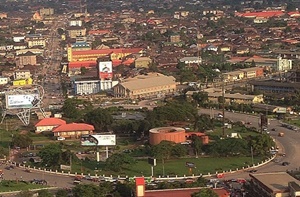
The study area includes the cities of Abomey-Calavi, Allada and Cotonou which are located in the south of Benin. This area covers two (02) Km2 and is located between N6°21' and N6°39' and between E2°09' and E2°26' (Figure 1). It is characterized by four seasons (two dry seasons and two rainy seasons), with a humid and sub-equatorial climate. The soils encountered in the study area are varied. The city of Cotonou is mostly covered with hydromorphic soils and only slightly with tropical ferruginous soils. The cities of Abomey-Calavi and Allada are mostly covered by hydromorphic soils and ferralitic soils, and only slightly covered by tropical ferruginous soils. The study area is located in the Guinean zone characterized by bimodal rainfall with an annual average of 1,200 mm from 1987 to 2016 (Orounladji et al., 2021). These conditions predispose the study area to the development of urban plant species. While the city of Cotonou remains the most populous in the country, the cities in the study area cumulate a total population size of about 1462337 people in 2013 (INSAE, 2015).
Figure 1: Map of the study area
Data collection
In each city, urban plant species in public green spaces were inventoried using the roving method. Two types of green spaces were considered: shade rows (paved or asphalt roadways with trees) and greened public spaces, which are public spaces containing planted trees. The itinerant survey consists in counting all the species encountered by walking through a biotope in all directions. This method has already been used in several studies (Kouadio et al., 2016; Kouassi et al., 2018). The height and circumferences of all trees that have a diameter greater or equal than 10 cm were recorded.
Processing methods and statistical analysis
Dendrometric characteristics
Structural characteristics were estimated by green space type. The dendrometric variables to be estimated to characterize the identified plant groups are: density, stem diameter, average basal area, basal area per hectare, average Lorey height.
Average diameter
The quadratic diameter (dgi, in cm) is the measure of the average diameter of trees that is traditionally used in silviculture. It is calculated by the following formula:
With di the diameter of a tree i measured within the transects and n the total number of transect trees considered.
At each green space, the average diameter (Dg) will be estimated by:
Average basal area
The basal area (gi), expressed in m²/ha, at each transect was determined by the following formula:
With S = 0.09 ha; di is the diameter of a tree i measured within the plot.
In the green areas, the basal area (G, expressed in m²/ha) is calculated through the formula below:
With gi the basal area at a transect and plot level
Height of Lorey
The height of Lorey (HL) of the green spaces was calculated by the formula :
Where hi is the total height of tree i measured in the field and gi is its basal area (gi = Πdi²/4)
Structure of diameter and height stands
The structure of diameter was constructed at the level of each town and plant formation by grouping diameters into classes with 50 cm of amplitude each and heights were grouped into classes which have 2m as amplitude.
Spatial distribution
The Blackman Index (BI; Jayaraman, 1999) was calculated in order to study the spatial distribution of a species. The Blackman index allows us to assess the distribution of trees of a given species within a given vegetation grouping. Results are showed by urban forest type. The Green Index (GI) was also calculated and allows the detection of the spatial configuration of the species. It is an improved version of the Blackman Index (BI).
and are respectively the mean and variance of the density of the species in the plant formation. n is the total number of trees and IG varies from 0 to 1. It is interpreted as follows: GI = 0 (random distribution) and GI> 0 (aggregative distribution).
Quantification du stock de carbone et de la biomasse aérienne
In the cities of the study area, the urban equations known as UGES (Urban General Equations) were used for estimating the biomass of tree species. These equations presented in the literature are the most suitable for urban trees, given their specificity (Nomel et al., 2019). Three allometric equations were defined according to the type of species (deciduous, palm, coniferous):
(1) Deciduous Biom = 0,16155 x DBH2,310647
(2) Palm Biom = 1,282 x (7,7H+4,5)
(3) Coniferous Biom =0,035702 x DBH2,580671
In these formulas, Biom refers to total biomass expressed in kg/stem; DBH is diameter at breast height at 1.30m from the ground expressed in cm; H is palm height in meters.
Using this approach, we generated biomass estimate values for each recorded tree. Sequestered carbon was then quantified by summing the biomass value of all trees in all considered green spaces, and dividing the total by the area of the considered green spaces. A carbon content conversion factor of 0.47 was used (Martin and Thomas, 2011). The corresponding carbon equivalent or CO2 was determined by multiplying the carbon stock by 3.67.
Statistical analysis
After calculating the dendrometric parameters (density, stem diameter, mean basal area, basal area per hectare, Lorey’s height), an analysis of variance was performed to assess their difference between the different habitats. When the probability is significant at 5%, a structuring of the means is done by the Student Newman Keuls (SNK) post hoc test through agricolae package (de Mendiburu, 2020). Regarding the diameter and height class distributions, a linear regression was used to identify the relationship established between class centers and their respective density according to habitat types. Bar charts with error bars were constructed to visualize the diameter and height structures by habitat through the ggplot2 package (Wickham, 2016). Statistical analyses were performed under R software version 4.0.5 (R Core Team, 2021).
RESULTS
Structural characterization in relation to cities
Density and dendrometric parameters
The results of the analyses revealed that the density, mean diameter and surface area vary significantly at the 5% threshold among the cities (Table 1). The average diameter is higher in Abomey-Calavi (165.915 cm) compared to Allada (103.014 cm) and Cotonou (114.983 cm). Similarly, basal area is higher in Abomey-Calavi (11.54118 m²/ha) compared to the other two cities.
Table 1:
Table 1: Density and dendrometric parameters according to the cities
Diameter and height class distribution and population stability
The proportion of individuals in the diameter class (50-100 cm) is higher in all cities (Figure 2). There are more large-diameter trees in Cotonou than in the others two cities. In addition, all cities have individuals in all height classes. The highest proportions of individuals are found in the classes (6-8 m; 8-10 m; 10-12 m and 12-14 m).
Figure 2: Diameter and height structure by city
Structural characterization in relation to green space types
Density and dendrometric parameters
The results of the analyses revealed that only the density varies significantly (p < 0.05) according to plant formations (Table 2). Density is higher in shade rows (80,380 trees/ha) compared to the greened public spaces (40,500 trees/ha).
Table 2: Density and dendrometric parameters and regeneration according to vegetation
Diameter and height class distribution and population stability across plant formations
The proportion of individuals in the diameter classes (50-100; 100-150 cm) were higher in all plant formations (Figure 3). The trees with the largest diameters and most remarkable heights were found in the shade rows compared to the greened public spaces. In addition, all towns have individuals in all height classes. The trees that are most represented have heights varying between 6 and 8 m in the greened public spaces, whereas the greatest representativeness varies between 6 and 14 m in the shade rows.
Figure 3: Diameter and height structure by vegetation
Spatial distribution
The Blackman (BI) and Green (GI) indices values (Table 3) are all greater than 1 and 0 respectively, in all study cities and at the vegetation formation level. However, these values are relatively low within cities. These indices indicate that the plant species present in the public green spaces of the cities of Abomey-Calavi, Allada and Cotonou are distributed in a gregarious manner.
Table 3: Parameters for determining the spatial distribution
Total biomass and carbon stock of trees
In all the areas inventoried in the study area, the total biomass is 1406.77 t/ha. This biomass value corresponds to a sequestered carbon stock of t/ha. The total green spaces considered accumulate an amount of CO2 that is equivalent to 2426.49 t/ha (Table 4). If we consider the spaces separately, the shade rows have a higher amount of biomass (639.09 t/ha) than the vegetated public places (386.24 t/ha). However, the carbon sequestered by trees in the city of Abomey-Calavi (319.82 t/ha) is much higher than in the city of Allada (141.23 t/ha) and Cotonou (200.12 t/ha).
Table 4: Value of aboveground biomass and stored carbon
DISCUSSION
The results of the study showed a low density of plant species in green spaces both in cities and in the types of urban forest studied. This low density is the result of a daily and generalized problem throughout Africa, especially in urban areas. Indeed, the expansion of inhabited areas in African cities is done without any development plan and therefore in a disorganized way and without taking into account the vegetation cover (Konijnendijk et al., 2005). The destruction of urban biodiversity is also accelerated by development works (resettlement, road openings) undertaken in cities (Amontcha et al., 2015). Trees in green spaces are destroyed during the reprofiling and paving of roads. Nevertheless, the density of trees obtained in green spaces and especially for trees of alignments is the result of the few public policies. Indeed, the modern districts of some cities, notably in Cotonou and Abomey-Calavi, benefit from regular development. The beauty of these places attracts city dwellers and makes these spaces privileged places for population and especially young people to practice sports. As for the basal area, it is at least twice as high (11.54 m2/ha) at the level of green spaces in the city of Abomey-Calavi compared to Allada and Cotonou. Maybe this value is still low compared to those obtained by Vroh et al. (2014) in his study on urban plant diversity in the district of Plateau in Abidjan, Ivory Coast. This study reveals a basal area estimated at 62 m2/ha. This finding shows a weaker ability of the species studied to withstand a more or less strong pressure of use, because they are in urban environments, totally anthropized and therefore very detrimental or even fatal to the trees. The presence in great quantity of individuals of small diameter trees (0-50; 50-100; 100-150; 150-200 cm) compared to individuals of large diameter accounts for the stability of the environment. Indeed, the stability of an environment is ensured when the number of individuals in a forest stand decreases regularly when moving from small DBH trees to larger trees (Fandohan et al., 2008). This finding indicates a high turnover rate within the tree populations in the study area. The integration of trees in urban spaces to increase urban biodiversity seems to be a recent policy. The presence of larger diameter trees in the city of Cotonou, which is the economic capital of the country, confirms that the majority of the trees found there are the result of previous colonial development policies.
The low values of Blackman's and Green's indices are not only indicative of a low clustering of tree individuals in Benin's cities, but also of an aggregative spatial distribution. This aggregative spatial distribution of urban plant species reflects the extensive anthropization of their living environment. Indeed, the seed dispersal strategies adopted by a plant can be linked to the dispersal agent (Comita et al., 2007; Nishimura et al., 2008).
Biomass is higher in shade rows than in greened public spaces. Also, the quantity of carbon stored per hectare in shade rows is greater than in greened public spaces. Between cities, Abomey-Calavi stores significantly more carbon per hectare than Cotonou and Allada. This variation in the amounts of carbon stored and aboveground biomass in these types of green spaces could be explained by the density of trees per hectare in these spaces and the distribution of the basal area. The higher values of these two parameters measured in the shade rows indicate the presence of a high number of large-diameter individuals. In addition, the carbon storage capacity of urban trees is limited because most of these species are exotic and therefore far from their natural habitats. In fact, the sequestration capacity of trees is a function of environmental conditions. The carbon sequestered would be more important when it is found in their ecological niches (Vroh, 2016). The carbon sequestration power of trees in urban environments testifies to the importance of urban green spaces in the fight against global warming (Penman et al., 2003), particularly greenhouse gases, including CO2, which remains the primary heating gas. The preservation of urban biodiversity becomes more urgent especially with the reduction and disappearance of natural forest resources. It is therefore necessary to ensure the survival of urban plant biodiversity and to continue to plant in order to benefit from the compensatory effect of urban trees on CO2 emissions.
CONCLUSION
The public green spaces in the cities of Abomey-Calavi, Allada and Cotonou have a low density. The city of Abomey-Calavi has the highest density of plant species. At the level of green space types, shade rows have the highest density. The study shows a discontinuity of urban trees in the different diameter classes. The trees are in an aggregative spatial arrangement but with a low number of tree individuals within each group. The trees studied accumulate an average of 661.17 tons of carbon per hectare and play a full role in regulating and cleaning the air in urban ecosystems. This study demonstrates the importance of urban spaces in the vitality of the urban environment. It is therefore imperative that appropriate policies be setted up to ensure the management and maintenance of urban plant biodiversity. These adequate policies will also allow to obtain a healthy and ecologically viable environment. They become emergent for the construction of sustainable cities for present and future generations.
REFERENCES
Akionla, M. (2012). Diversité et fonctions des formations végétales dans la ville de Porto-Novo. Mémoire de DESS en Gestion de l’Environnement, Université de Parakou, Bénin, 83p.
Amontcha, A., Lougbegnon, T., Tente, B., Djego, J., & Sinsin, B. (2015). Aménagements urbains et dégradation de la phytodiversité dans la Commune d’Abomey-Calavi (Sud-Bénin). Journal of Applied Biosciences, 91(1), 8519–8528.
Amontcha, A. M., Djego, J. G., Imorou, I. T., & Sinsin, B. A. (2017). Phyto-diversite et utilisations des espaces verts prives dans les villes du grand Nokoue (Sud-Benin). Journal de la Recherche Scientifique de l’Université de Lomé, 19(2), 117-139.
Consolloy, J. W. (2000). Planting and maintenance. In Handbook of Urban and Community Forestry in the Northeast (pp. 189-204): Springer.
De Mendiburu F. 2020. agricolae: Statistical Procedures for Agricultural Research. R package version 1.3-3. https://CRAN.R-project.org/package=agricolae
Fandohan, B., Glèlè Kakaï, R., Sinsin, B., & Pelz, D. (2008). Caractérisation dendrométrique et spatiale de trois essences ligneuses médicinales dans la forêt classée de Wari-Maro au Bénin. Rev. Ivoirienne Sci. Technol, 12, 173-186.
Georgi, J. N., & Dimitriou, D. (2010). The contribution of urban green spaces to the improvement of environment in cities: Case study of Chania, Greece. Building environment, 45(6), 1401-1414.
Gregg, J. W., Jones, C. G., & Dawson, T. E. (2003). Urbanization effects on tree growth in the vicinity of New York City. Nature, 424(6945), 183-187.
INSAE. (2015). Rgph4: Que retenir des effectifs de Population en 2013. Direction des études démographiques, 33p. [2021/02/19].https://insae.bj/images/docs/insae-statistiques/demographiques/population/Resultats%20definitifs%20RGPH4.pdf
Konijnendijk, C. C., Nilsson, K., Randrup, T. B., & Schipperijn, J. (2005). Urban forests and trees: a reference book: Springer.
Kouadio, Y. J. C., Vroh, B. T. A., Bi, Z. B. G., Yao, C. Y. A., & N’guessan, K. E. (2016). Évaluation de la diversité et estimation de la biomasse des arbres d’alignement des communes du Plateau et de Cocody (Abidjan-Côte d’Ivoire). Journal of Applied Biosciences, 97, 9141-9151.
Kouassi, J. K., Kouassi, H. K., & Kouassi, H. R. (2018). Evaluation de la diversité floristique et estimation du taux de séquestration de carbone des arbres en alignement de voies de la commune de Daloa (Côte d’Ivoire). International Journal of Biological and Chemical Sciences, 12(4), 1876-1886.
Lawrence, A. B., Escobedo, F. J., Staudhammer, C. L., & Zipperer, W. (2012). Analyzing growth and mortality in a subtropical urban forest ecosystem. Landscape Urban Planning 104(1), 85-94.
Martin, A. R., & Thomas, S. C. (2011). A reassessment of carbon content in tropical trees. PloS one, 6(8), e23533.
Nomel, G. J. R., Kouassi, R. H., Augustin, A. S., & N’guessan, K. E. (2019). Diversité Et Stock De Carbone Des Arbres D’alignement: Cas d’Assabou Et Dioulakro De La Ville De Yamoussoukro (Centre De La Côte d’Ivoire). Journal of Environmental Science, Toxicology and Food Technology, 13(4 ), 84-89.
Orounladji BM, Tozo SK, Chrysostome CAAM. 2021. Morphobiometric characteristics and biodiversity of indigenous guinea fowl (Numida meleagris) in Benin. Journal of World’s Poultry Research, 11(1), 136-150. https://dx.doi.org/10.36380/jwpr.2021.18
O’Donoghue, A., & Shackleton, C. M. (2013). Current and potential carbon stocks of trees in urban parking lots in towns of the Eastern Cape, South Africa. Urban forestry & urban greening, 12(4), 443-449.
Osséni, A. A., Tohozin, C. A. B., Toko Mouhamadou, I., & Sinsin, B. (2014). Contribution des SIG dans l’analyse floristique des espaces verts dans la ville de Porto-Novo au Bénin. Revue Ivoirienne des Sciences et Technologie, 23, 103-121.
Penman, J., Gytarsky, M., Hiraishi, T., Krug, T., Kruger, D., Pipatti, R., Tanabe, K. J. L.-u. c. (2003). Good practice guidance for land use. Land-use change Forestry, 3.
Quigley M. F. J. U. E. (2004). Street trees and rural conspecifics: Will long-lived trees reach full size in urban conditions? Urban Ecosystems, 7(1), 29-39.
R Core Team. 2021. R: A language and environment for statistical computing. R Foundation for Statistical Computing, Vienna, Austria. URL https://www.R-project.org/.
Sehoun L. C., Osseni A. A., Orounladji M., Lougbegnon T. O., Codjia J. C. T. (2021). Diversité floristique des formations végétales urbaines au Sud du Bénin (Afrique de l’Ouest). Rev. Mar. Sci. Agron. Vét. 9(2): 266-273
Shackleton, C. M. (2012). Is there no urban forestry in the developing world? Scientific Research and Essays, 7(40), 3329-3335.
Stoffberg, G., van rooyen, M., van der Linde, M. J., & Groeneveld, H. T. (2010). Carbon sequestration estimates of indigenous street trees in the City of Tshwane, South Africa. Urban forestry & urban greening, 9, 9-14. doi:10.1016/j.ufug.2009.09.004
Teka, O., Togbe, C. E., Djikpo, R., Chabi, R., & Djossa, B. (2017). Effects of Urban Forestry on the Local Climate in Cotonou, Benin Republic. Agriculture, Forestry and Fisheries, 6(4), 123.
Viswanathan, B., Volder, A., Watson, W. T., & Aitkenhead-Peterson, J. (2011). Impervious and pervious pavements increase soil CO2 concentrations and reduce root production of American sweetgum (Liquidambar styraciflua). Urban Forestry and Urban Greening, 10(2), 133-139.
Vroh, B. T. A., Tiebre, M.-S., & Kouakou Edouard, N. G. (2014). Diversité végétale urbaine et estimation du stock de carbone : cas de la commune du Plateau Abidjan, Côte d’Ivoire. Afrique SCIENCE, 10, 329-340.
Vroh, B. T. A. (2016). Evaluation de la diversité et estimation de la biomasse aérienne des arbres du jardin botanique de Bingerville (District d’Abidjan, Côte d’Ivoire). European Scientific Journal, 12, 185-201. doi:10.19044/esj.2016.v12n6p185
Wickham H. 2016. ggplot2: Elegant Graphics for Data Analysis. Springer-Verlag New York.